I’m not sure I have sufficient language to convey the
vastness of my last couple of weeks, so I’ll be perforce fairly reductive here. I’m just filled with awe and gratitude at
having been able to hike up to and around and through the Khumbu Valley, home
of glaciers and spectacular views and also…the tallest mountains in the world. I
hiked over 100 miles, gaining about 10000 feet of altitude along the way, and got to land
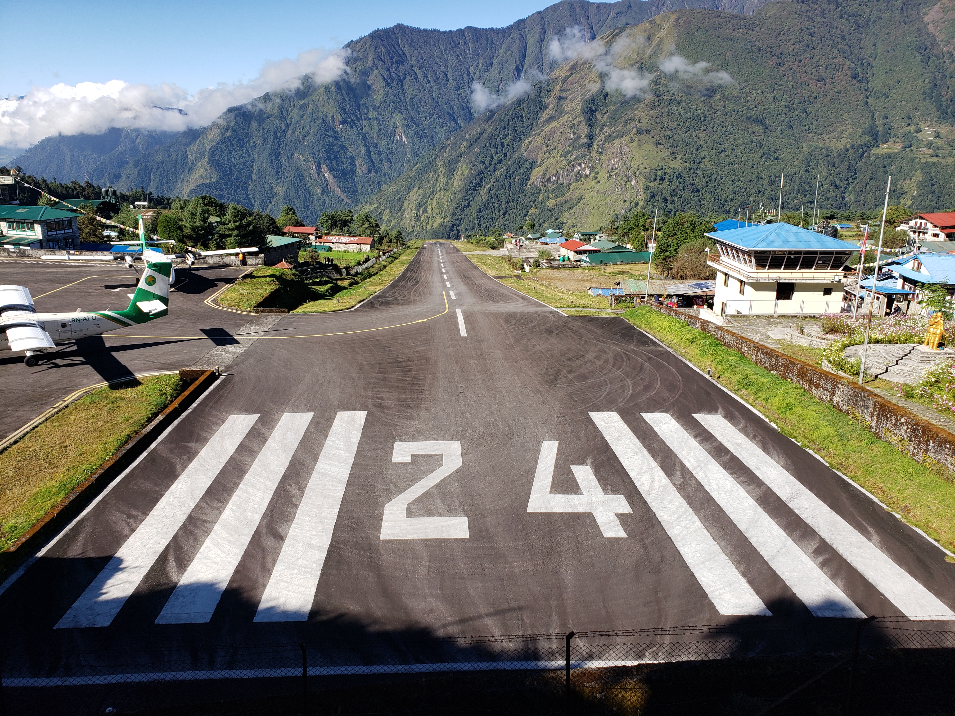
at the world’s most dangerous airport to boot!
(Lukla airport's [in]famous super-short runway ending off a cliff)
I have to say that it was not hard hiking. (Ala-Kul in Kyrgystan a few weeks back was a
much more technically difficult hike.) The
trails through the Everest region are pretty well-worn thoroughfares because they
are the only way to get from one village to another up there. The entire region is sparsely but
consistently populated with Sherpa villages, and the Sherpa people live and work and
farm and do their thing and walk up and down and between villages to visit
friends and get supplies and do the things that people do when they live their
lives, and the track around and to and through the Khumbu Valley is their
neighborhood throughway. Those villages--their ingenious farms, their complex social interconnections, and their near-animistic devotions--are an unexpected joy of trekking in the region.
(Namche Bazaar, the region's largest village, from above)
The whole of Sagarmatha National Park
(the huge area in which Everest is just one of many peaks) is just unspeakably
beautiful, with one dramatic white 7500m+ peak after another, a breathless
procession, an incantation in rock: Mera,
Kusum, Kongdaree, Kyashar, Kangtega, Ama Dablam, Tobuche, Cholatse, Lobuche, Lotse,
Nuptse, Pumori, and Chomolungma, as the Sherpa people call Everest. This last is, honestly, is the least dramatic
of them all, except perhaps in the imagination.
(Cholatse, Lobuche, and the Chola valley in between)
(Kangtega at evening)
(Ama Dablam, with stupa and yaks)
The thing that makes trekking the region difficult is,
obviously, altitude. Happily, altitude
wasn’t really a problem for me, until it was.
I had excellent pulse-ox readings—like, 60 bpm and 94-95%—consistently throughout
the upward climb until the night I slept in Lobuche village, at about 5000
meters (16300ish feet). That night while
I slept, my oxygen cratered to about 75%. I woke up in a full-blown
heart-racing panic attack at 2am knowing absolutely that I was about to die and
had to get off that mountain. I threw my sleeping bag across the room, stripped off my clothes, and headed out into the
night, making excellent decisions with my very clear brain. I somehow talked myself out of streaking down
the frozen trail and back inside my spartan teahouse room, and muttered calm if clenched encouragement to myself for the
rest of the night. I took half a Diamox in the morning with breakfast (the only
time I took that altitude drug) and pressed onward and upward. By the time I
got to Goruk Shep village (about 17000 feet) a few hours later, I was fine, mostly
back to myself, a little tingly (side effect of Diamox), with my oxygen over 90 again.

(Khumbu Glacier)
Let me mention briefly the place that is the focus of most
folks’ attention when they trek through the Sagarmatha region: Everest Base
Camp. It was cool, fine, love the Khumbu
Glacier and the famous Icefall for sure, but it really was less interesting
(and more crowded) than pretty much everywhere else in the region. My heart was already lost, anyway, to all the other mountains,
and the lovely villages, and the baby Buddhist monks in training, and the
epic-scale views in every direction, and the impossibly high timberline, and
the million waterfalls, and the coldly dazzling stars, and the endless refills
of dal bhat. To my mind, EBC is, at best, a place to take a photo.


.png)